

Quick answer
The abraham lake ice bubbles viewpoint is accessible 24 hours daily with no entrance fee or gate. Optimal lighting and bubble visibility occur between 10:00 and 14:00 when midday sun penetrates the ice. The lake ice typically forms mid-December through late March, with the clearest bubble formations visible before heavy snowfall obscures the surface.
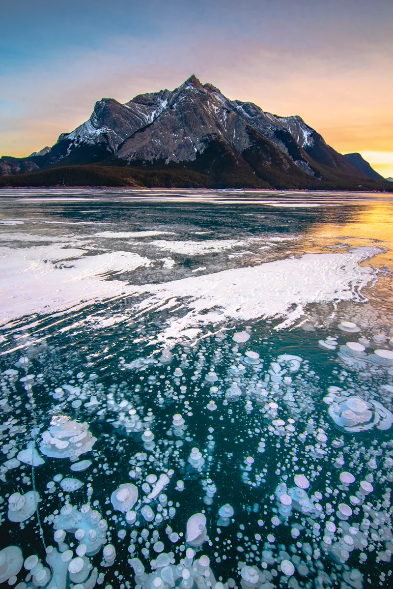
Methane gas released from decaying organic matter on the lakebed rises through the water column and freezes in vertical stacks when it meets the ice ceiling. The result is a column of white discs suspended in clear ice, visible only when the surface remains free of snow and opaque frost. Abraham Lake is a man-made reservoir created in 1972 by the Bighorn Dam on the North Saskatchewan River. The lake's high elevation and consistent winter cold produce ice thick enough to walk on by mid-January, though conditions vary each season and ice safety remains the visitor's responsibility. Highway 11 runs along the eastern shore, offering multiple pull-offs where the frozen shoreline can be accessed on foot. The most photographed formations cluster near Preacher's Point and the Windy Point pull-off, roughly 20 kilometers south of the lake's northern tip. Midday light minimizes glare and allows the translucent ice to reveal bubble depth. Early morning and late afternoon produce long shadows that can obscure detail, though the warm light favors wide landscape compositions. Wind sweeps snow from exposed sections of the lake, leaving patches of glass-clear ice alongside drifted areas. Visitors should carry ice cleats, check weather forecasts for wind and temperature, and avoid venturing far from shore without local knowledge of ice thickness. The phenomenon has drawn increasing attention since 2014, when social media circulation brought the site into the winter-tourism circuit. Weekdays in January and February see the lightest crowds. The David Thompson Highway remains open year-round, though winter driving requires snow tires and caution on exposed sections subject to black ice and crosswinds. No facilities exist at the pull-offs; the nearest services are in Nordegg, 60 kilometers north.
“Methane gas rises through the water column and freezes in vertical stacks when it meets the ice ceiling, visible only when the surface remains free of snow.”
Optimal Timing for Visiting the Abraham Lake Ice Bubbles Viewpoint
The period from January to early March provides the necessary conditions for methane bubbles to freeze within the ice. Midday, specifically the best arrival window of 10:00–14:00, offers the highest visibility and safer lighting conditions for observing the lake surface.
January–February
ModerateCold, -10°C to -20°C
This core winter period offers the most stable ice thickness for viewing bubbles.
Early March
HighChilly, -5°C to -10°C
As temperatures rise, snow cover may increase, occasionally obscuring bubble visibility.
Midday (10:00–14:00)
Peak—
This window provides optimal natural lighting and safety for navigating the frozen lake surface.
Verdict: The best time to visit is during the heart of winter, specifically January and February, arriving between 10:00 and 14:00.
Access Hours for the Abraham Lake Ice Bubbles Viewpoint
The Abraham Lake ice bubbles viewpoint remains accessible to the public throughout the week. Visitors may access the area at any time, as there are no restricted operational hours.
| Monday | 00:00–23:59 | Always open |
|---|---|---|
| Tuesday | 00:00–23:59 | Always open |
| Wednesday | 00:00–23:59 | Always open |
| Thursday | 00:00–23:59 | Always open |
| Friday | 00:00–23:59 | Always open |
| Saturday | 00:00–23:59 | Always open |
| Sunday | 00:00–23:59 | Always open |
Directions to the Abraham Lake Ice Bubbles Viewpoint
Abraham Lake is located along the David Thompson Highway (Highway 11) in Clearwater County, Alberta. The most practical way to reach the ice bubbles viewpoint is by personal vehicle, as there is no public transit access to this remote area.
David Thompson Highway (Highway 11) from Red Deer
David Thompson Highway (Highway 11) from Banff/Lake Louise
David Thompson Highway (Highway 11) from Jasper
Top Photography Angles at the Abraham Lake Ice Bubbles Viewpoint
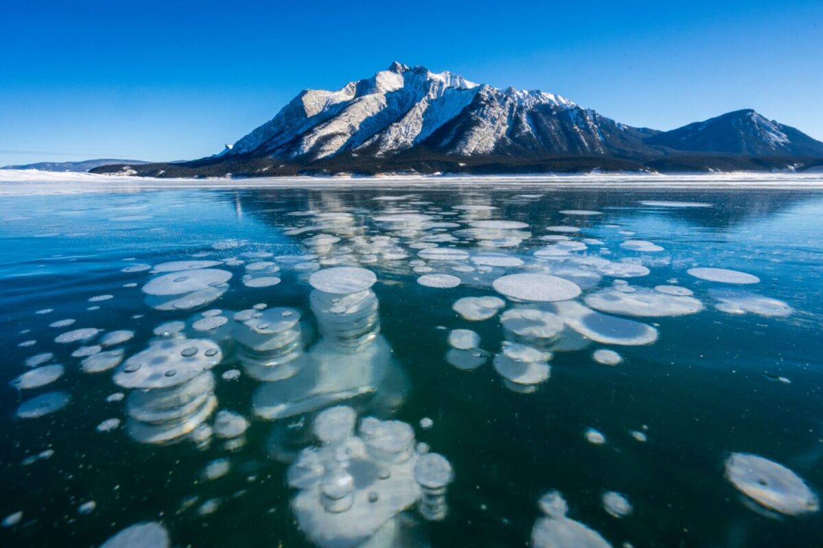
Preachers Point
Position your tripod low to the ground near the shoreline to capture the bubbles against the surrounding mountain peaks.
Main Shoreline Access
Focus your lens on the clear ice patches where methane bubbles congregate near the water edge.
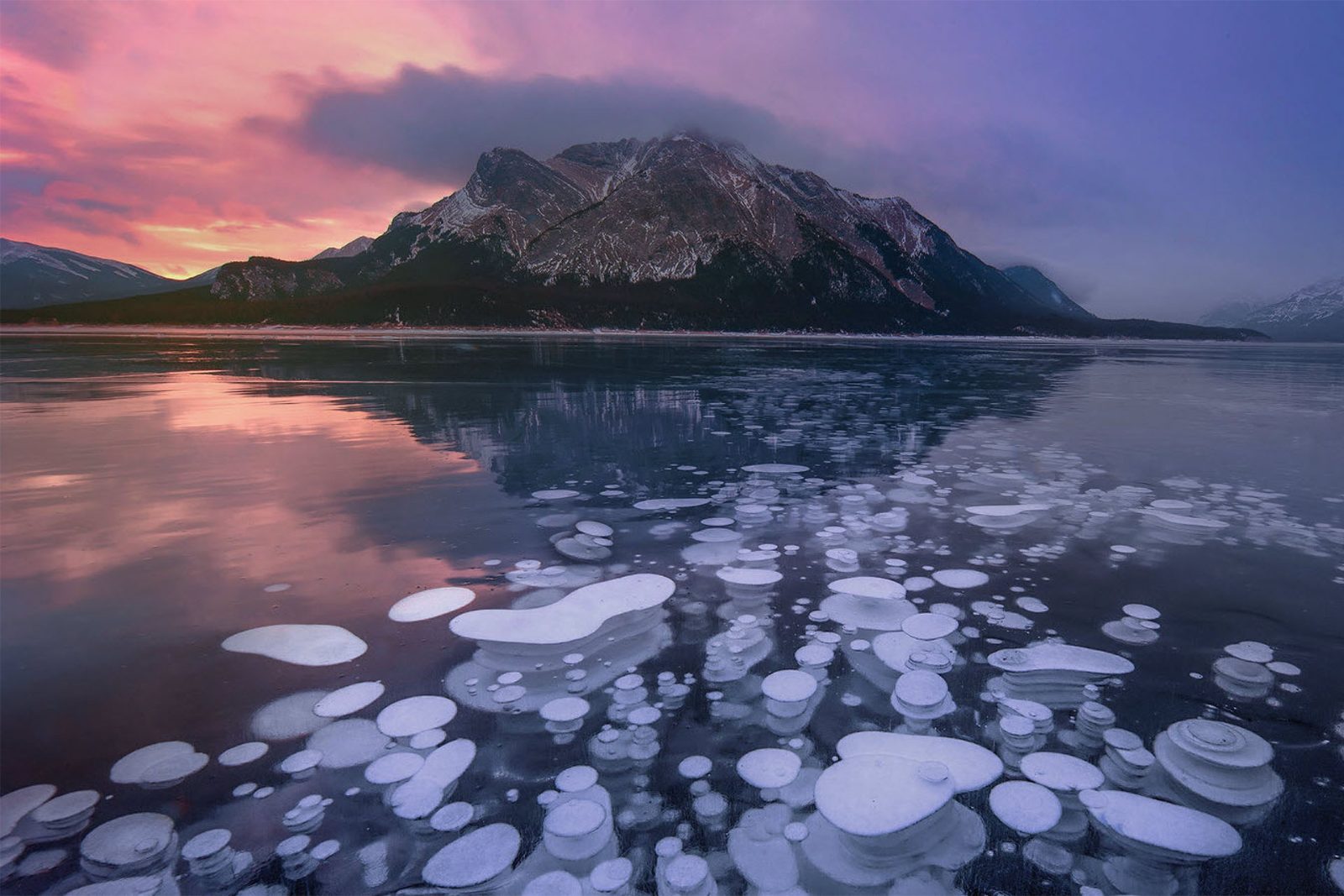
Cline River Delta
Capture the panoramic view of the lake surface where delta sediments meet the trapped ice bubbles.
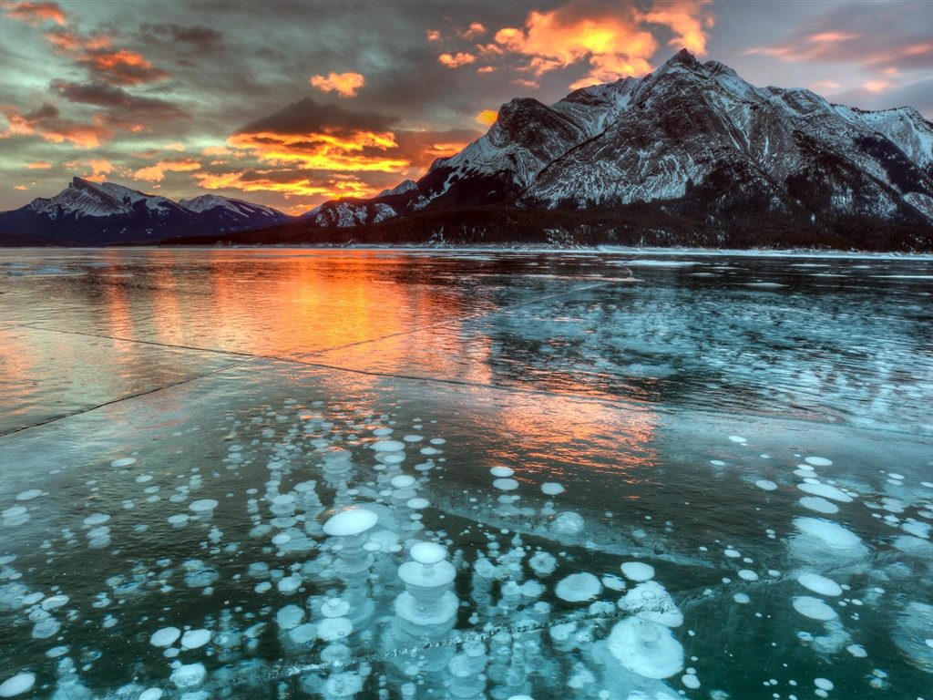
Windy Point Shore
Angle your camera to isolate dense clusters of bubbles against the deep blue ice background.
Safety Mistakes to Avoid at the Abraham Lake Ice Bubbles Viewpoint
Abraham Lake's frozen methane bubbles draw visitors onto ice that can be dangerously thin or unstable. Avoid these errors to stay safe while viewing the formations.
Walking onto ice without checking thickness
Test ice thickness with a pole or stick before stepping out. Stay near shore where ice is typically thicker, and never venture alone.
Ignoring weather forecasts before heading out
Check Environment Canada forecasts for the David Thompson Highway corridor. Wind chill can reach -40°C, and sudden storms reduce visibility to zero within minutes.
Relying on cell service for emergency help
The viewpoint has no cellular coverage for most carriers. Carry a satellite communicator or inReach device, and inform someone of your route and return time.
Wearing inadequate footwear on slippery ice
Use ice cleats or crampons over insulated winter boots. The lake surface is glare ice in most areas, making falls common without traction aids.
Driving Highway 11 without winter tires and supplies
The David Thompson Highway is remote and unlit, with frequent closures during storms. Carry a survival kit, extra fuel, food, water, and a fully charged phone with offline maps.
Check availability
Frequently Asked Questions About Abraham Lake Ice Bubbles
Everything you need to know about abraham lake ice bubbles viewpoint